Closing the Telemetry Gap: A New Receiver Array in the Bay of Biscay
2025-09-25


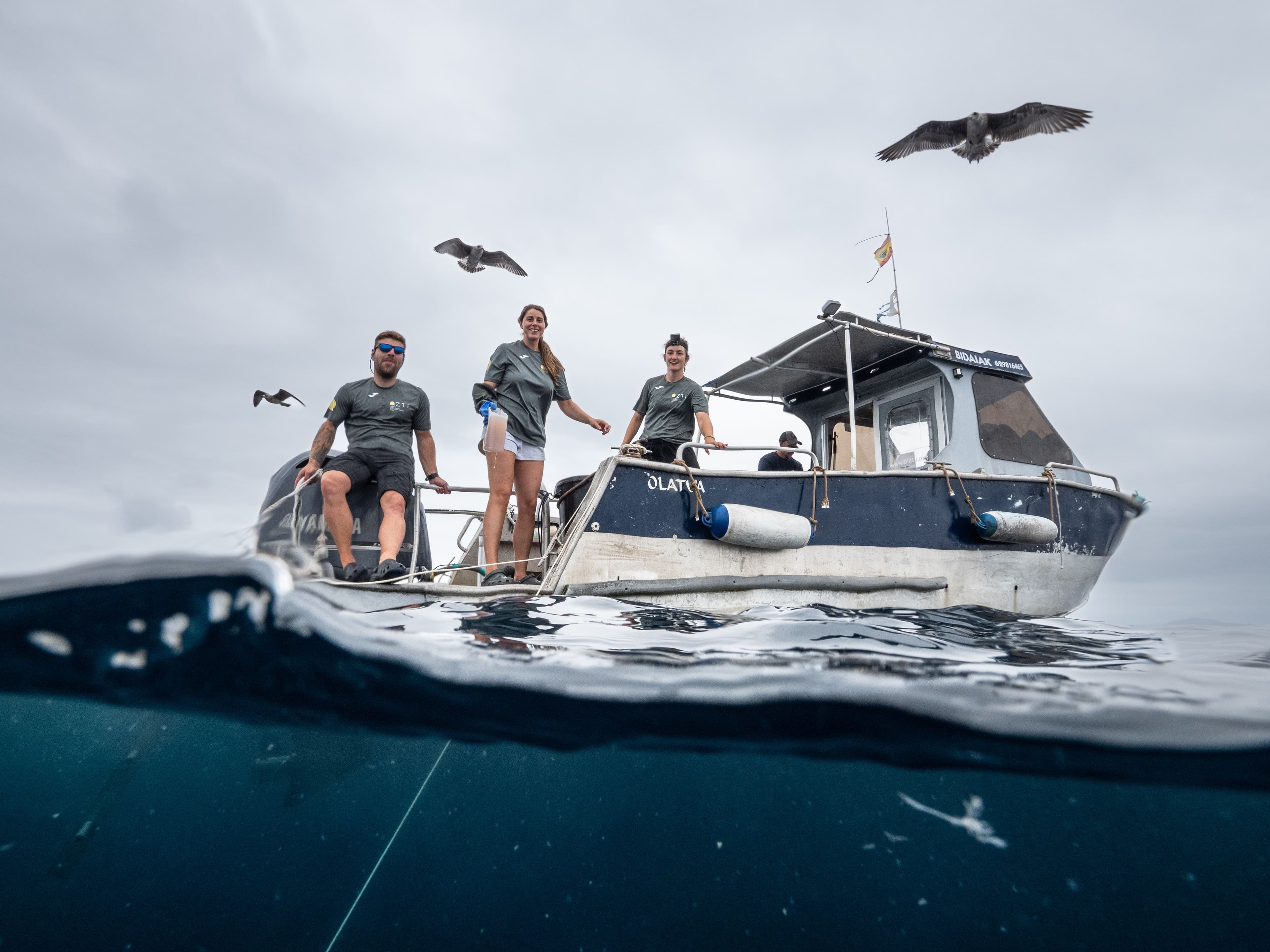
The Thelma Biotel Team
Closing the Telemetry Gap: A New Receiver Array in the Bay of Biscay
est. reading time: 8 minutes
In this blog post, you’ll learn about the design choices behind the new Basque Tracking Network (BTN) - why researchers are building it, how they’re tackling the Bay’s unique challenges, and what kind of data they hope to unlock.
The Scientific Objective: Filling Europe’s Blind Spot
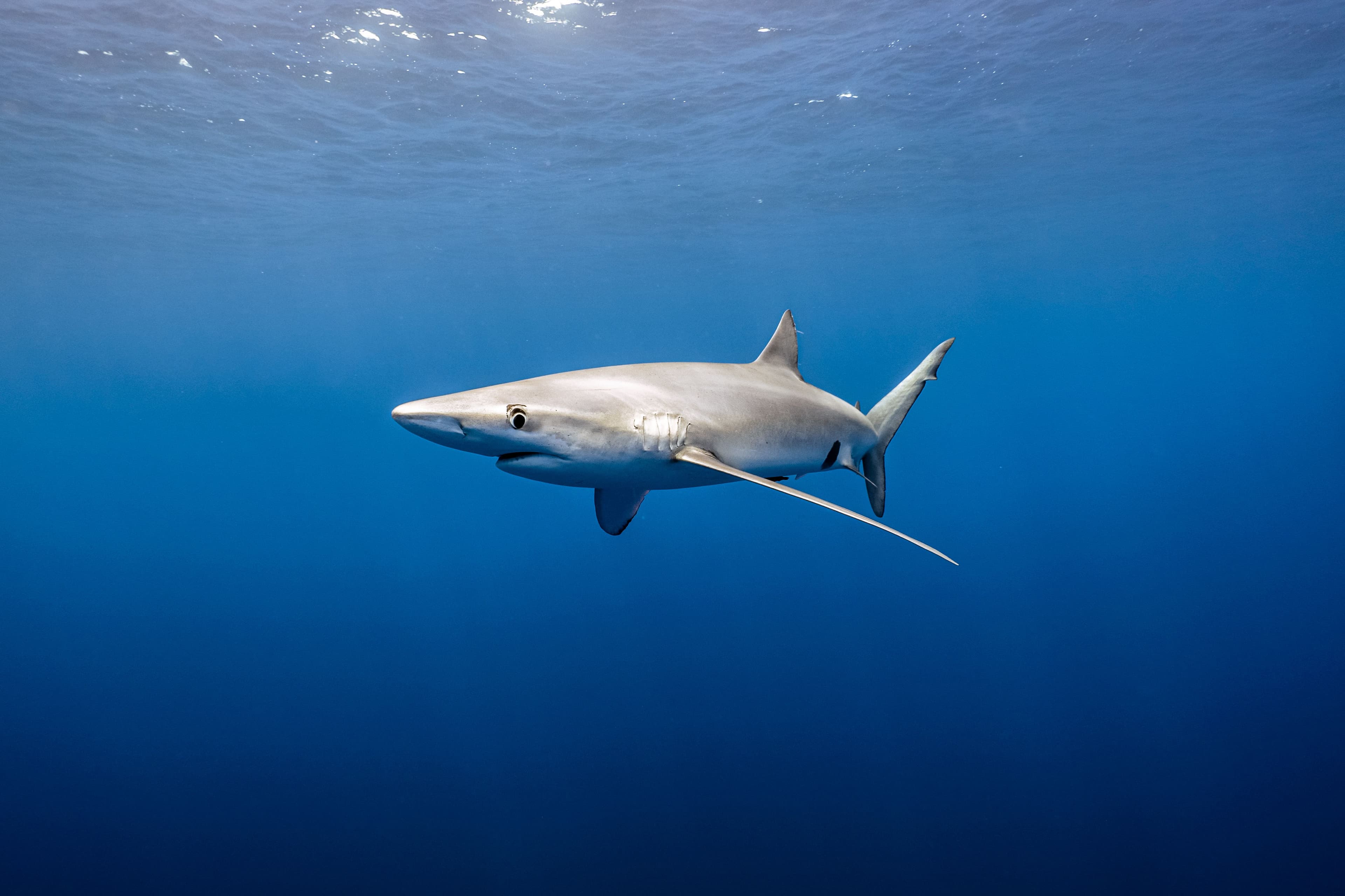
For pelagic shark research, the Bay of Biscay has long been a frustrating gap. Blue sharks, makos, and other wide-ranging predators appear regularly in the region, but only briefly in satellite tag datasets or as occasional landings in fisheries reports. Without continuous detections, researchers have been left to speculate:
- Do pelagic sharks remain in the Bay year-round, or are they just summer visitors?
- Are the sharks feeding, mating, or using the Bay as a nursery?
- Do individuals travel toward Galicia and then off into the North Atlantic, or are they entering from the north and moving offshore again?
As Dr. Maite Erauskin from AZTI explains, “We thought they were only here in summer, but now we suspect they may stay longer. The array will finally let us test this - to see if they cross, if they stay, and how long they use the Bay. This will be key to understanding broader dynamics of shark populations in this part of the North Atlantic.”
Beyond sharks, the BTN also addresses a broader European gap. While the Atlantic coasts of Ireland, Portugal, and France host acoustic arrays, the Bay of Biscay has remained an empty space in the European Tracking Network (ETN). Closing this gap will not only illuminate pelagic shark behavior but also reveal movements of eels, tuna, and even migratory crustaceans.

The Challenges Ahead
Designing an array in the Bay of Biscay is not as simple as drawing lines on a chart. The region presents researchers with a daunting set of physical and operational hurdles:
- Depth and Morphology: The shelf break plunges quickly into deep canyons such as the Gouf de Capbreton. Deployments here risk burial in soft sediments, strong currents, and complex retrievals.
- Weather and Storms: Winter in the Bay brings violent storms and waves that can exceed 10 meters.
- Tides and Currents: With tidal ranges of up to four meters and strong currents in canyon mouths, receiver positioning must balance coverage with survivability.
- Fishing Effort: Trawlers and longliners work much of the slope and shelf edge.
- Data Loss Risk: Perhaps the biggest psychological weight: every receiver that fails or vanishes may take irreplaceable data with it. As Maite puts it bluntly, “The biggest concern is to lose one of the receivers - not just for the cost, but for the data it might have collected.”
These challenges mean every design decision carries weight. Placement, spacing, and depth must balance scientific ambition against logistical risk.
The Trade-off: Coastal Line or Offshore Gates?
Option A: A continuous line of receivers close to shore
In practice: This would mean laying out receivers in a straight line parallel to the coast, all at a consistent depth and distance offshore, maximizing linear coverage.
- Pros: Easier to service with AZTI’s own small boats; less exposure to winter storms; lower cost if equipment is lost.
- Cons: Limited to shallow areas, missing sharks that spend time along the slope or in canyon habitats.
Option B: Offshore “gates” stretching from shallow to deep
In practice: This involves laying out receiver lines that start near the coast and extend across the shelf into waters 500–600 meters deep, creating acoustic “checkpoints” spaced across the Bay, providing more likelihood of detecting highly mobile species as they cross.
- Pros: Capture both habitat use and in–out migrations; reveal whether sharks enter from the north, exit toward Galicia, or linger inside the Bay.
- Cons: Harder to reach, especially in winter; exposed to strong currents and fishing activity; higher risk of losing receivers.
The Basque team ultimately chose gates, accepting higher risk for the chance to collect more meaningful data. Australia’s IMOS network gave inspiration: their early nearshore arrays were limited, but once offshore gates were deployed across shelf breaks, large-scale migrations of sharks along Australia’s coast became visible. Without such gates, important movements would have remained hidden (Braccini et al., 2017).
Dr. Maite Erauskin-Extramiana summarized the dilemma: “If we put receivers only in shallow areas, it may be easier in terms of receiver management. We could use our own smaller boats close to the coast. But the sharks are not always close to the coast. But want to see part of the slope, the canyons, the deeper waters. The gates give us the chance to see if they cross, if they stay, and how they actually use these waters.”
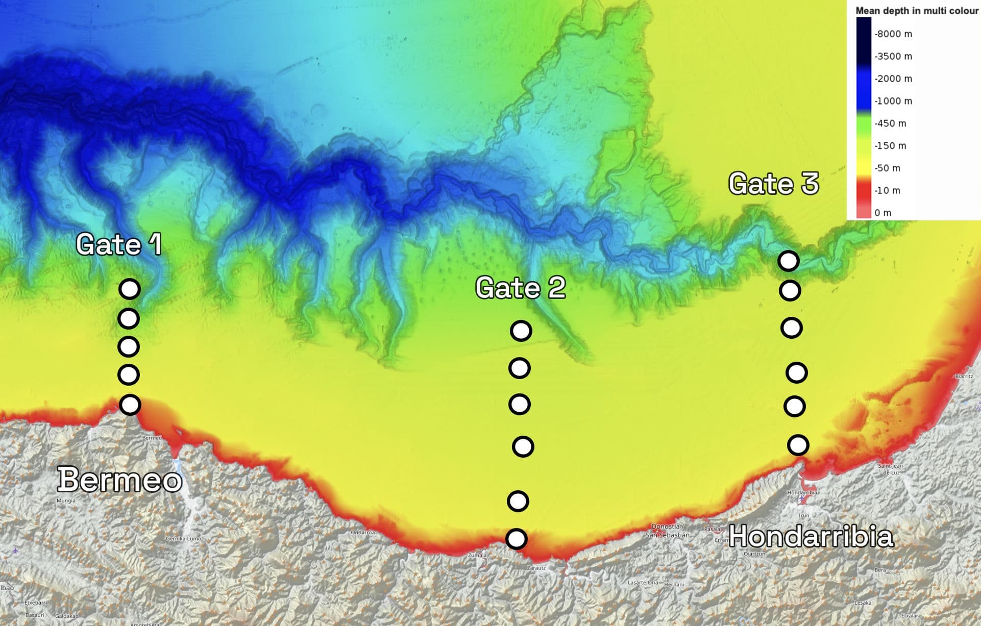
The Final Receiver Array Design
The Basque Tracking Network will launch with 27 receivers arranged in a hybrid design that combines broad gates with targeted placements in ecological hot spots. Three design elements stand out:
- East–West Gates to Capture Migration
Two receiver lines extend out from Hondarribia (east) and Bermeo (west), running from the coast into waters 500–600 meters deep. In practice, this creates two “checkpoints” across the Bay. If sharks cross one line but not the other, researchers can infer whether they stayed inside, passed through, or shifted offshore. - North–South Gradient for Habitat Use
Within each gate, receivers span shallow shelf zones into the deep slope. In practice, this vertical coverage reveals how sharks use the Bay’s habitats — hugging the coast, shifting offshore at night, or diving into canyons seasonally. - Strategic Points Beyond the Gates
Receivers are also deployed in a handful of ecological hot spots — for example, around aquaculture structures, at buoys where fish naturally aggregate, and inside areas where fishing is restricted. In practice, these placements strategically extend coverage at sites of interest for multiple species, adding ecological context to the backbone formed by the gates.
Together, this design balances broad-scale coverage with targeted ecological insight. The gates provide the backbone for tracking migrations, while the gradient and hot spots allow finer-scale questions about habitat use and anthropogenic influence.
Looking Ahead: From Risk to Reward
Every acoustic array carries responsibility, and in the Bay of Biscay the stakes are high. Each receiver lost to storms or currents does not just mean lost hardware - it means potentially irreplaceable data.
As Dr. Maite Erauskin put it, “The biggest concern is to lose one of the receivers, not only the cost, but the data that it may have collected. The dream is to keep it running for years, to see the bigger picture of shark movements and how they connect our waters with the wider Atlantic. Thus, we are happy to have so many partners on board helping us realise this array.”
Despite the risks, the potential rewards are significant. The dream data is a long-term record of pelagic shark movements: when they enter the Bay, how long they stay, and whether they dive into canyons or migrate south. Combined with detections of tuna, eels, and other species, the BTN will close one of Europe’s largest telemetry blind spots.
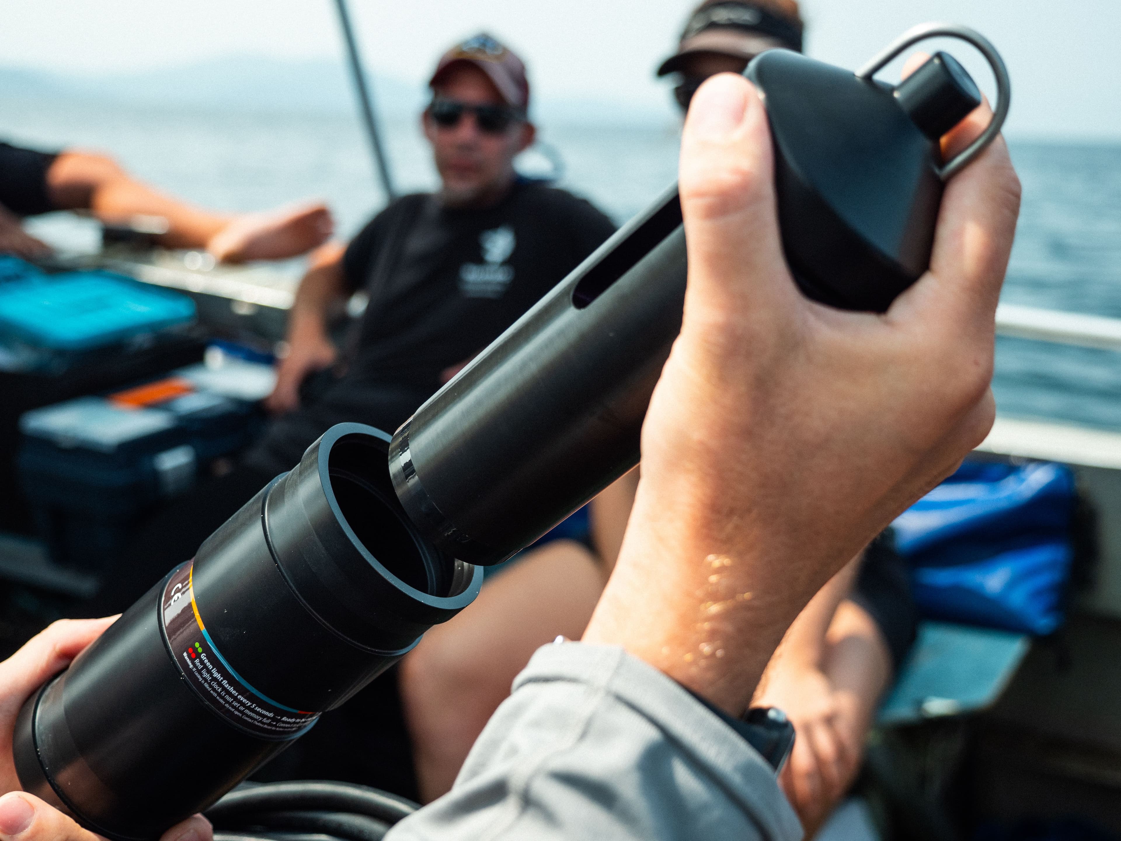
Because the array runs on open protocol, every compatible tag will be detected and shared through the European Tracking Network, linking Biscay to the wider Atlantic. For the deepest sites like the Gouf de Capbreton, the team relies on Thelma’s acoustic release system, making deep retrievals possible and hopefully elucidating fish movements in one of Europe’s most fascinating marine ecosystems. The project itself rests on collaboration: receivers supplied as a loan from the Ocean Tracking Network (OTN), paired with Thelma Biotel’s support and AZTI’s leadership.
🔬 Plan Your Array
Thinking about your own deployment? Talk to our engineers and team about array designs that balance coverage and risk.
🌊 Deep Deployments, Made Simple
Curious how acoustic release systems can open up canyon and slope habitats for telemetry? Learn how Thelma tools make deep-water retrievals safe and reliable.
🧑🔬 Tell Us About Your Design Choices
What trade-offs are you facing in your own telemetry study? Share your design challenges with Thelma - your insights could shape future tools and guides for fish scientists.
Mooring Recovery System
TBR 800 Release with the Mooring Recovery system for a secure and clean recovery.


